

If the saying goes, “There’s no bad weather, just inappropriate clothing,” then with the right gear you can explore some great places deep in the mountains of Colorado. With just over 17,000 acres, James Peak Wilderness Area gives you a multitude of options for snowshoeing and cross-country skiing. Covering my two favorites, are the Crater Lake Trail (just outside of Rollinsville) or tackling James Peak Summit- the flagship of the wilderness area.
Crater Lake Trail- The trail works its way above the Moffat Tunnel (fourth longest railroad tunnel in North America), and along the South Boulder Creek. There are a lot trails you can pick from here, and all seem to lead to an alpine lake of some kind. Crater Lake is the best for snowshoeing, with the Continental Divide dramatically crowding around the lake (and the steep accent seems to deter the cross-country skiers).
![IMG_0273[1]](https://peak2peakers.com/wp-content/uploads/2019/03/img_02731.jpg?w=768)
![IMG_E1930[1]](https://peak2peakers.com/wp-content/uploads/2019/03/img_e19301-e1551639740864.jpg?w=768)
![IMG_E1952[1]](https://peak2peakers.com/wp-content/uploads/2019/03/img_e19521.jpg?w=768) The last markers states, “Crater Lakes- One Mile”. Maybe as the crow flies, but it sure seems much longer than that. Once the crowds thin out, the forest comes alive. The towering pines out here feel very old, ancient maybe. In the thick of the trees, the mountains peak through from time to time. The wind is howling above, but it’s still as can be in the trees. An occasional glob of snow falls with a resounding thud. The scene makes me feel as if Burl Ives may pop his head out and start singing, “Silver and Gold”. At least it was stuck in my head from time to time as I was hiking.
The last markers states, “Crater Lakes- One Mile”. Maybe as the crow flies, but it sure seems much longer than that. Once the crowds thin out, the forest comes alive. The towering pines out here feel very old, ancient maybe. In the thick of the trees, the mountains peak through from time to time. The wind is howling above, but it’s still as can be in the trees. An occasional glob of snow falls with a resounding thud. The scene makes me feel as if Burl Ives may pop his head out and start singing, “Silver and Gold”. At least it was stuck in my head from time to time as I was hiking.
![IMG_0268[1]](https://peak2peakers.com/wp-content/uploads/2019/03/img_02681.jpg?w=768)
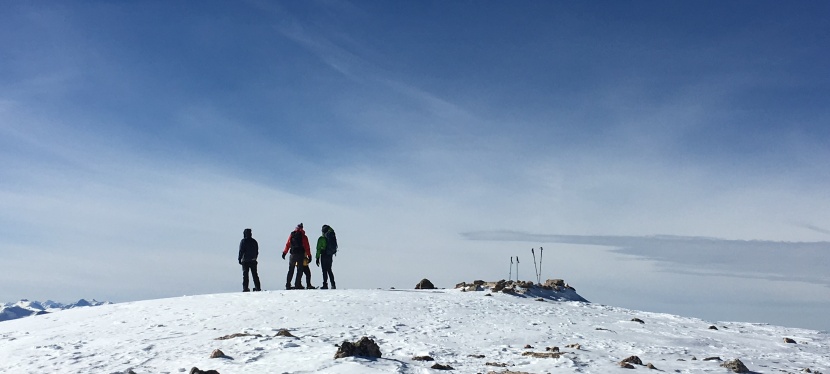
Head back the way you came in. If you get confused, always take the trail that leads downhill. As soon as the snow pack hardens and widens, I shed my snowshoes for cleats. I pick up the pace without my clumsy shoes, and head for a warm pub.
![IMG_2551[1]](https://peak2peakers.com/wp-content/uploads/2019/03/img_25511.jpg?w=768) James Peak Summit- If your more interested in hiking above the tree line, then head to James Peak. More than an hour’s drive from Rollinsville, it’s hard to believe you’re in the same park. This is essentially the same hike I laid out on my summer hike post. In the summer, St Mary’s Glacier is a sad, beat up block of ice. In the winter, it’s at its full potential. With its deep chalk blue ice, it’s just like a glacier should be. It’s fun to watch all the creative ways people play on the glacier. Everyone comes out of the woodwork, from kids with saucer sleds, snowboarders, and cross-country skiers. They were even giving ice axe lessons up here.
James Peak Summit- If your more interested in hiking above the tree line, then head to James Peak. More than an hour’s drive from Rollinsville, it’s hard to believe you’re in the same park. This is essentially the same hike I laid out on my summer hike post. In the summer, St Mary’s Glacier is a sad, beat up block of ice. In the winter, it’s at its full potential. With its deep chalk blue ice, it’s just like a glacier should be. It’s fun to watch all the creative ways people play on the glacier. Everyone comes out of the woodwork, from kids with saucer sleds, snowboarders, and cross-country skiers. They were even giving ice axe lessons up here.
Now is the time to don your snowshoes and take note of Lunch Rock- a small out-cropping of boulders to lead you back home. I only used my snowshoes for the big, mile long meadow from the glacier to the switchbacks leading up the summit. Reaching the top, you’re welcomed with stunning panoramic views. In the winter, the views are even more special- with the snow packed peaks and clear skies. Unfortunately, in the summer you can have a lot of haze from the increase of forest fires. From here, you can spot Winter Park. See if you can spot trains entering the Moffat Tunnel. On the way back, it’s important to keep an eye out for Lunch Rock- there are a lot of ways down, and no clear route back to St Mary’s Glacier.
![IMG_E2331[1]](https://peak2peakers.com/wp-content/uploads/2019/03/img_e23311.jpg?w=768)
Thanks for reading,
Special thanks to Editor Andi
![IMG_E2351[1]](https://peak2peakers.com/wp-content/uploads/2019/03/img_e23511.jpg?w=768)
![IMG_E2336[1]](https://peak2peakers.com/wp-content/uploads/2019/03/img_e23361.jpg?w=768)
![IMG_E2322[1]](https://peak2peakers.com/wp-content/uploads/2019/03/img_e23221.jpg?w=768)
